When the air itself turns against youThey are known by many names: Haboob, Simum, Black Blizzards. A solid wall of dust almost a mile high, moving whole sand dunes and bringing Biblical darkness to the huge areas of the world. Scorching hot winds (up to 40 degrees
Celsius) blowing the sand around with
hurricane speeds… What seems extreme to us is actually a common occurrence in Africa and the Middle East. The similar sand-saturated hurricane-speed storms over Mediterranian are called Sirocco, Yugo and Ghibli. The dust (or desert sand) particles become airborne and held in
suspension, creating a moving front. The convection of cold air over the heated ground maintains the storm and keeps the dust rolling.
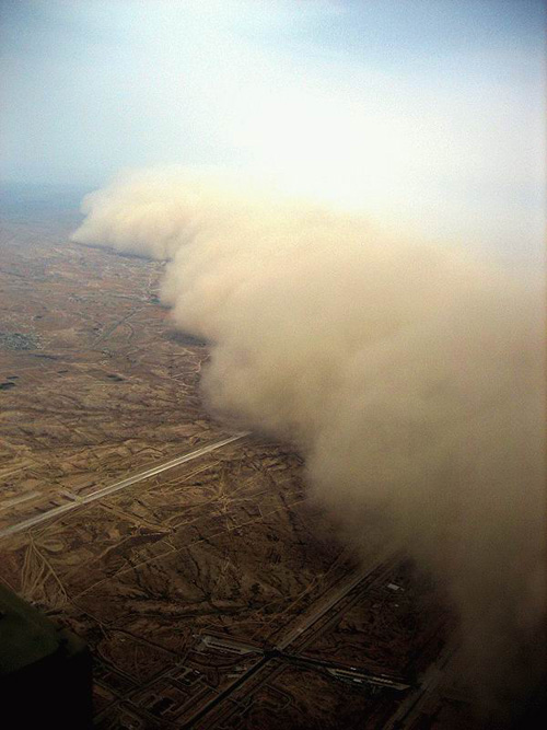
See one such storm coming
into the Israeli Negev desert from Sinai (advancing with the speed of appr. 40 mph). According to the photographer Eviathar ben Zedeff , the sand wall is over 4,000 ft high:


 (images credit: TheAugeanStables)
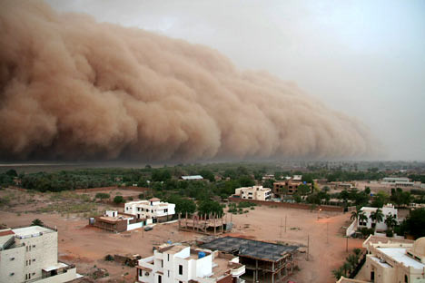
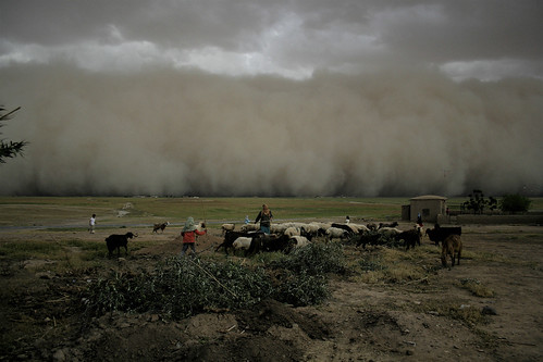
Sand Storm in Khartoum, Sudan:
Here is an alarming fact: sand storms now happen ten times more frequently than fifty years ago. For example, Mauritania had only two storms per year in the early Sixties, now it’s more like EIGHTY a year. Sahara’s sand is also being sent into the Atlantic at an accelerated pace (five times growth in one year, since 2006!) – however, this could be a good thing, according to Wikipedia, as it will cool off the ocean enough to slightly ease the ongoing 2007 hurricane season.
The Dust Bowl Ecological DisasterNorth America did not escape the arrival of these
monsters, either. The “Black Dusters” of the 30s repeatedly swept the
Great Plains (nicknamed the Dust Bowl), with dust trail stretching all the way from Texas to Chicago. This
agricultural disaster was caused by a
combination of factors, most notably by the excessive farming, done without a crop rotation, coupled with severe drought. Here is a historic photograph of a dust storm in Texas, taken in 1935:
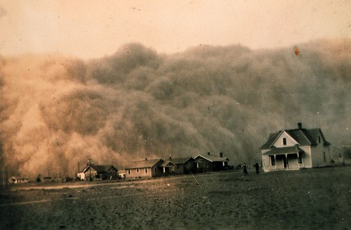
The Dust Bowl disaster caused a major exodus of the Great Plains population, a displacement of up to 2.5 million people. (15% of Oklahoma moved to California, for example)
This is how they described the inside of a “Black Blizzard”:
“Nothing was visible without electric light; you could not see five feet in front of you at certain points…. (the storms) came without warning and left everything in their paths with a clinging mantle of black silt.”The following video shows the similar wall of sand, this time in Iraq, turning day into the darkest night:
(It seems to be the same storm that the pictures showed in our previous post “Atmosphere Goes Nuts”)
Space imagery helps to better understand the scale of such events: For example, this is a dust storm over Burkina Faso, covering almost the whole country -
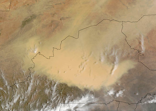 (image credit: NASA/Goddard Space Flight Center)
Sirocco and other near-hurricane speed winds bring the dust and sand over the ocean… A giant plume of sand is swept off the African coast and Sahara desert, reaching hundreds of miles into the Atlantic:
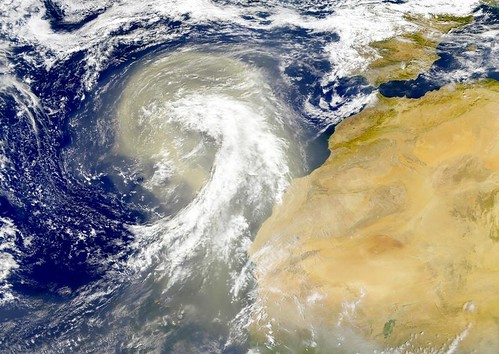 (image credit: NASA/Goddard Space Flight Center)
Dust covers Astana, the new capital of Kazakhstan:
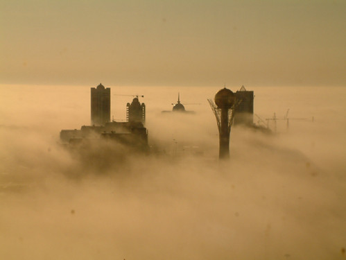
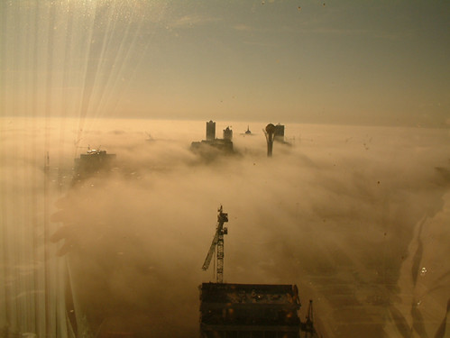
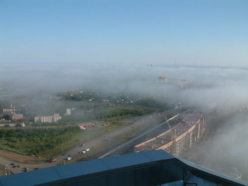 (images credit: ochevidec.net)The Grime and the Beauty
The awesome scale and a certain atmospheric effects of the sand storms open new possibilities for photographers (just keep your camera tightly packed when a sandstorm hits).
The dust storm in Arizona creeps from the left corner in this spectacular picture. The brilliant sunset paints the skies, all the more colorful because of the fine dust particles suspended in atmosphere. This photo reminds me of the work of Dale Terbush, a talented “painter of light” from Arizona.
 (image credit: Jared Kruger)
a detail:
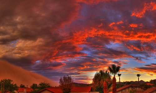
Phoenix, Arizona – the dust storm coming in:
 Sent in by Chris from higherground4x4.com
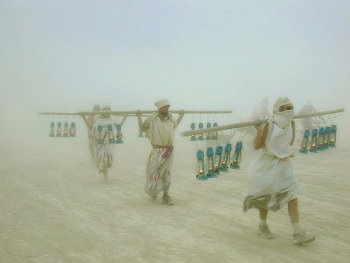
The lamps can make all the difference in the pitch-dark of a storm.
“The lamplighters brave the dust storm in Nevada desert” -
 (image credit: Bradford Dallas)Mystery Picture
:
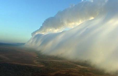
The next picture may look like an incoming dust storm, but it is just a cloud front. Notice the “surfer”, er… glider riding this “Cloud Front Wave”:
(we would like to find out the location of this photo, for its seems to be a relatively common occurrence there)

This cloud phenomena is The Morning Glory” cloud bank, sweeping over the remote Australian outback of northern Queensland.
